


 The Australian Beach Boys Show
03 May 2026 - Renmark
 The Italian Tenors
09 Apr 2026 - Renmark
 Ireland The Voyage
24 Feb 2026 - Renmark
 Kevin Bloody Wilson Aussie Icon Tour with special guest Jenny Talia
27 Mar 2026 - Renmark
 Lewis Major: Triptych
14 Mar 2026 - Renmark
Thanks for using Discover Murray River
Walker Flat Water Level Updates
Here are some recent photos of water levels at Walker Flat:
Photos Uploaded in February 2010
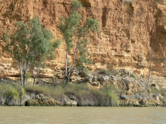
Walker Flat on 23 Feb, 2010
Photo: Murraylands Regional Tourist Association
Some fantastic Cliffs up at Walker Flat dipping down to the waters edge. You can see them from the Ferry or up from look out or by boat/canoe Brilliant
Photo: Murraylands Regional Tourist Association
Some fantastic Cliffs up at Walker Flat dipping down to the waters edge. You can see them from the Ferry or up from look out or by boat/canoe Brilliant
Water level photos from towns near Walker Flat

| Mannum Water Levels |

| Wongulla Water Levels |

| Blanchetown Water Levels |

| Bowhill Water Levels |

| Caurnamont Water Levels |
There's PLENTY of water for a great holiday in Walker Flat!
All photos and descriptions are supplied by the community. If you have anyrecent photos of the Murray, please upload them to help us show that
there's plenty of water for fun and adventure!

Walker Flat Town Guide
Towns Close By: Mannum, Swan Reach, Wongulla, Blanchetown, Bowhill, Younghusband, Nildottie, Caurnamont, Purnong, Punyelroo, Black Hill, Cambrai, Sedan, Mount Pleasant, Mount Pleasant
Tell your friends you found this at murrayriver.com.au!
Copyright Discover Murray 2026. This site or any portion of this site must not be reproduced, duplicated, copied, sold, resold, or otherwise exploited for any commercial purpose that is not expressly permitted by DISCOVER MURRAY.